DSMAC Scene Matching
Correlate the scene.
Compare visual features with reference imagery for GNSS-denied position estimation.
Sovereign Air Superiority through Scalable & Intelligent Autonomous Units with TERCOM + DSMAC fusion.
TERCOM (Terrain Contour Matching) and DSMAC (Digital Scene-Matching Area Correlator) form the navigation layer in a ROS2-based, Gazebo-validated environment. Together they compare terrain contours, scene features, and reference imagery, pairing with redundant visual landmarks, leader-follower coordination, and encrypted telemetry when GNSS is denied.
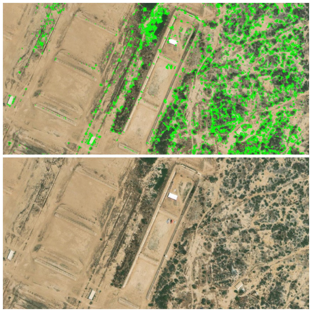
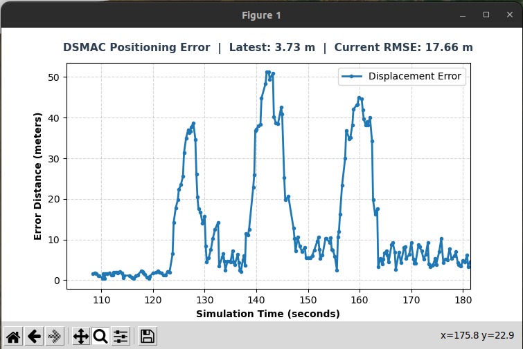
DSMAC validation run
Review the QGroundControl simulation view as DSMAC scene matching and positioning-error traces are evaluated during a GNSS-denied run.
Core capabilities that make GNSS Denied Navigation effective in real operational environments.
A closer look at the functions and workflows that define GNSS Denied Navigation.
Operational outcomes
The practical advantages teams gain when deploying GNSS Denied Navigation in the field.